
Intense rainfalls in Switzerland: the case of Lausanne in 2018
The new norm?
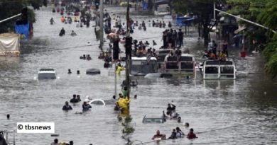
Flooded cellars, destroyed furniture and stocks, streets turned into rivers, cars washed away, billions of Francs of damage and even deaths. This is what Switzerland has been faced with in recent years. The centurial flooding of Bern of 2005 or the extreme rainfall in Lausanne of 2018 are two of the most impressive examples of such events. Because of climate change, it is believed that extreme weather will become more common in future years. Should we thus prepare to be faced with such events on a more regular basis?
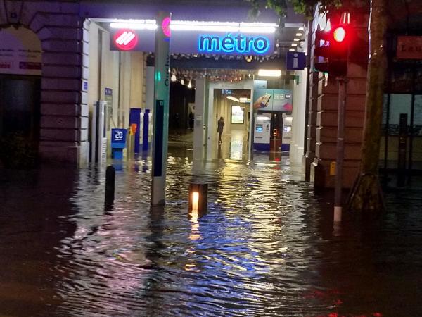
11 June 2018, Lausanne, 11 p.m. In ten minutes, 41 mm of rain fell on the capital of the canton of Vaud, setting a new national record for the most intense rainfall ever recorded in Switzerland. The massive thunderstorm that led to this number took place during a series of particularly hot months. A situation of barometric swamp stationary on Europe brought hot and humid air onto the Helvetic soil, which then led to thunderstorms in several parts of the country. The lack of wind inherent to barometric swamps increased the effects of the rainfall by not moving the clouds, thus concentrating all the precipitations on smaller areas.
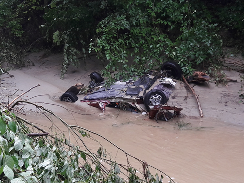
In Europe, thunderstorms are no rare events. They represent the most prominent actor in the loss of assured goods in Germany and the most destructive natural hazard in France. Extreme thunderstorms can often result in flash floods, which then cause extensive damages and can be lethal. In Lausanne, fortunately, no one was injured or killed, but the damages amounted to more than CHF 31’600’000.-.
The topography and the lack of pervious surfaces in the city resulted in the creation of intense precipitation runoff, turning streets into small but destructive rivers. The sewer system of the city was put under pressure because of the sudden augmentation of the volume of water it received, hence causing damages to some infrastructures and reflux of water in some habitations. Measures must be taken to prevent future similar events from causing as much damage. Fortunately, events of this magnitude are still extremely rare and should not occur again before several hundred years. However, because of climate change, the norm might well be shifted towards more intense rainy events. What is considered extreme today might become common in a few decades. Additionally, our cities are constantly growing, rendering pervious surfaces scarcer by the minute. It is thus indispensable to be aptly prepared via more resilient sewer and evacuation systems and to develop means to manage such important volumes of precipitation runoffs in the streets. A cohesive and forward-thinking land use planning will be of primal importance to accommodate to these events.
References
ECA – division prévention, 2019, personal communication.
Gaume, E. (2002). Eléments d’analyse sur les crues éclair. Sciences of the Universe. ENGREF (AgroParisTech).
MétéoSuisse (2018a). Bulletin climatologique juin 2018.
Michael Kunz, KIT Allemagne, 2019, personal communication.
Piper, D., & Kunz, M. (s.d.). Thunderstorm activity in central and western Europe – ESKP. Consulté le 26 avril 2019, à l’adresse https://www.eskp.de/en/natural-hazards/thunderstorms-in-central-and-western-europe/.